Juan Bautista de Anza National Historic Trail
Juan Bautista de Anza National Historic Trail is part of the National Trails System. It is not a park unit.
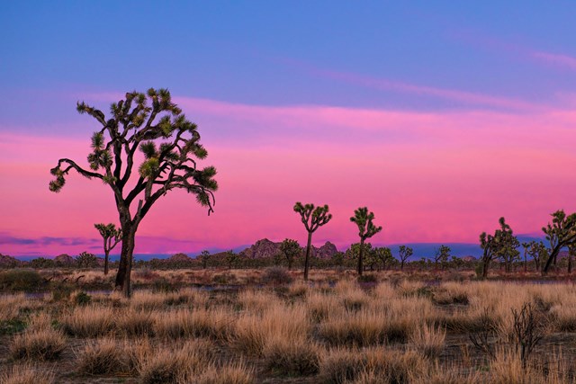
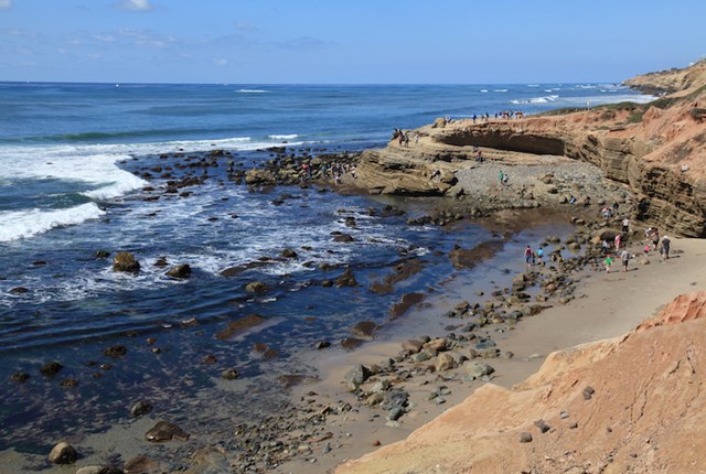
The Juan Bautista de Anza National Historic Trail covers over 1200 miles through the homelands of 70+ Tribal communities. It follows the historic route of the 1775-76 Spanish colonizing expedition from Sonora, Mexico to San Francisco, CA. Whether urban or rural, the trail offers adventure, diverse cultural perspectives, and an opportunity to experience history.
About 1.5 hours from Los Angeles, 1.5 hours from San Diego and 2 hours from Riverside by car.
Fees & passes
Free. No entrance fee here.
The Juan Bautista de Anza National Historic Trail crosses over 1200 miles from Nogales, AZ to San Francisco, CA. Please check with the local site administrator or land manager when visiting the trail to inquire about fees for entry. For example, California or Arizona State Parks for trail sections within State Park boundaries; local tribal, city or county governments; and federal land agencies.
Hours
| Administrative Staff Hours | Varies by day ▾
|
Visitor centers
- Santa Monica Mountains Anthony C. Beilenson Interagency Visitor Center ↗Passport stamp
The Santa Monica Mountains Interagency Visitor Center is located in what once was the ranch stables, which was part of King C. Gillette Ranch. The stables were refurbished to make it a visitor center.
- William Penn Mott, Jr. Presidio Visitor Center ↗Passport stamp
The visitor center is the go-to place to find out what is happening and what there is to do in the Presidio. Discover the Presidio through a large relief map, inspiring video, engaging exhibitions on history and nature, interactive tools, and knowledgeable staff that can help you uncover the…
- Anza-Borrego Desert State Park Visitor Center ↗
The Visitor Center is located at the west end of Palm Canyon Dr. Approaching from the west on S-22, make a left at the stop sign at the intersection of Montezuma Valley Rd and Palm Canyon Dr. Follow Palm Canyon Drive to the parking lot at the end.
- Saguaro National Park West - The Red Hills Visitor Center ↗Passport stamp
The Red Hills Visitor Center is a great place to learn about the park and start your visit to Saguaro National Park's West District. Views from the patio are spectacular and overlook the Red Hills and majestic Saguaro cactus forest nearby.
- Saguaro National Park East - Rincon Mountain District Visitor Center ↗
Saguaro National Park has two districts geographically separated by the city of Tucson. The Rincon Mountain District (RMD) is often referred to as Saguaro East, while the Tucson Mountain District (TMD) is often referred to as Saguaro West.
- Gila Bend Visitor Center ↗Passport stamp
An affiliated Arizona Office of Tourism Visitor Center, travelers can expect to find information about any of the four regions of our amazing State, as well as destination information about Gila Bend. Call (928) 683-2255 for more information.
Show all 8Hide
- Griffith Park Visitor Center ↗Passport stamp
Griffith Park Visitor Center, 4730 Crystal Springs Drive, Los Angeles, CA, 90027. Stop by the Visitor Center for information regarding Griffith Park activities, attractions, and permits.
- Big Break Visitor Center at the Delta ↗Passport stamp
The Visitor Center is accessible from Big Break Road. It includes hands-on and informational displays about the Delta. The center is staffed by Naturalists and Student Aides who are happy to share information about the park and activities in the area, including wetland walks and adjoining trails.
Explore
Things to do
- Hike the Anza Trail through Moreno Valley2-4 Hours
Enjoy an easy 8-mile out-and-back urban trail through Moreno Valley. This multi-use paved path starts at a city park and ends at a California state recreation area.
Opens on the Park Service site - Hike, cycle, or ride through Fort Ord National Monument30-150 Minutes
Hike or ride a strenuous 4.5-mile segment that crosses the majestic grasslands of Fort Ord National Monument. The Monument segment is anchored by the Creekside Terrace Trailhead and the Badger Hills Trailhead where restrooms, maps, and interpretive…
Opens on the Park Service site - Hike the Arrowhead Loop Trail2-5 Hours
Explore part of the Anza Recreational Retracement Trail by hiking this challenging 4-mile one-way loop through Coyote Valley Open Space Preserve in Santa Clara, CA.
Opens on the Park Service site - Hike the Delta de Anza/Mokelumne Loop2-4 Hours
Enjoy a moderate 5.62-mile loop by taking the Mokelumne Coast-to-Crest Trail to the Delta de Anza Trail. This paved loop passes through or near several schools and community parks and provides access to Contra Loma Regional Park and Black Diamond…
Opens on the Park Service site - Hike the Santa Cruz River30 Minutes
The Santa Cruz River forms a ribbon of life in the Pimería Alta. Whether walking to its edge or along its length, visitors will encounter the fundamental building blocks of nature and human civilization.
Opens on the Park Service site - Hike the Anza Trail from Tumacácori to Tubac, AZ2-6 Hours
Hike through shady cottonwood galleries and mesquite bosques along this six-mile stretch of the Anza Trail between Tumacácori National Historic Park and Tubac Presidio State Historic Park.
Opens on the Park Service site
Show all 7Hide
- Experience the Anza Trail by Train
Experience the Anza Trail with NPS volunteer historians and interpreters on board Amtrak's Coast Starlight between Santa Barbara and San Jose.
Opens on the Park Service site
Films
National Park Service productions, public domain.
Events
- 12:00 PM · runs through Dec 21 · freeMonterey History & Art Association Museum at Stanton Center 5 Custom House Plaza, Monterey, CA 93940
Map
Interactive map by the National Park Service
Public land nearby
Distances are approximate. Wilderness Atlas publishes a center point and an acreage for each area rather than a boundary, so each area is treated here as a circle of the same size and the figure is the gap to that circle.
Guidebooks for Arizona's national parks and the Southwest
We earn a small commission if you buy through these links. It does not change what we list.
Titles come from Open Library's catalog, matched by subject.
Reference
Activities
Activity guides for this park Hiking in the national parks · Horseback riding in the national parks
Questions people ask
Does Juan Bautista de Anza charge an entrance fee?
No. Juan Bautista de Anza is free to enter.
Source: National Park Service
What are the hours at Juan Bautista de Anza?
Standard hours are 9:30AM - 5:00PM on Monday, Tuesday, Wednesday, Thursday, and Friday, and it is closed on Sunday and Saturday.
Source: National Park Service
Follow this park
- Alerts feed (RSS)
- Every active Park Service alert for this unit, one item each, rebuilt with the nightly data refresh.
- Add dates to your calendar (.ics file)
- Fee-free entrance days that apply here and each published hours exception, as all-day events.
More in Arizona and California