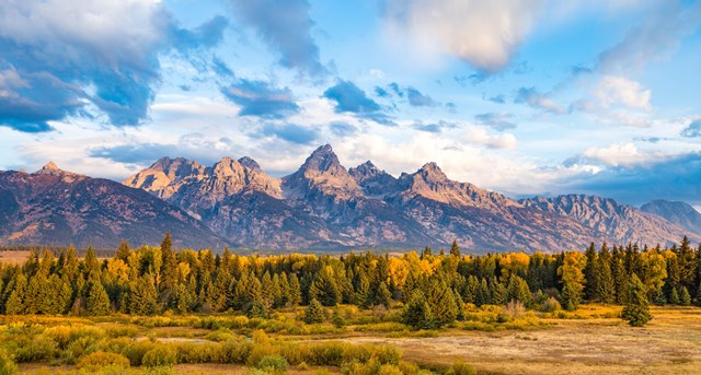
A line on a map does not always correspond to a path. Denali lets a walker choose a way through tundra and river valleys. Great Sand Dunes offers sand where the wind can erase a morning's footprints. Capitol Reef's washes supply routes without being built trails. These trips can be freeing, but they make the hiker responsible for the decisions a marked path usually settles: where to go, when to stop and how to get back.
The Park Service lists 22 units with off-trail permitted hiking. That does not mean every slope is open, nor that day-hiking access includes permission to camp. The parks below range from a relatively short walk beyond an established path to remote wilderness that demands experience. Read each park's current access and closure rules, then choose a route for the terrain you can actually handle. The most useful skill is knowing when a tempting line should stay only a line on the map.
The ten best national parks for off-trail hiking
01Denali
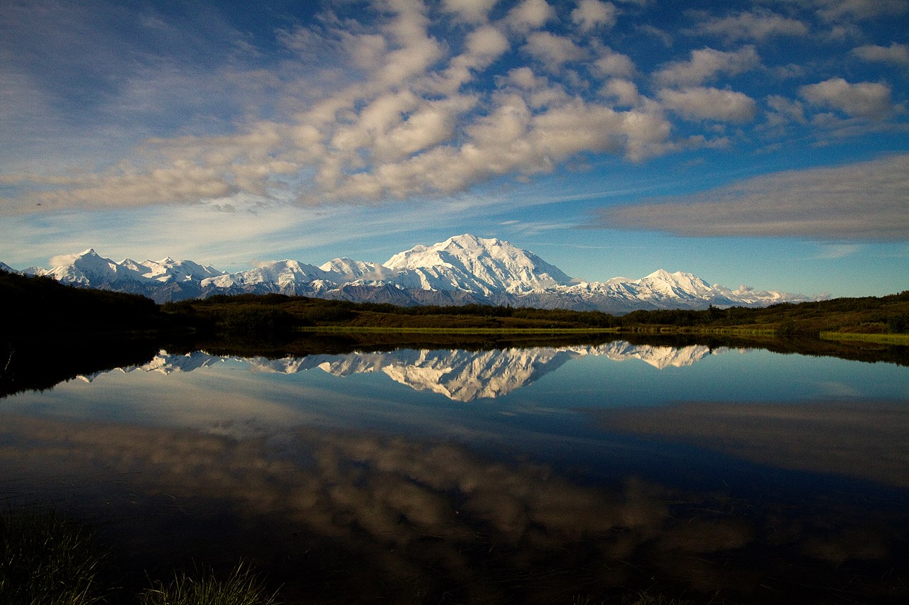
Denali fees, hours and alertsAway from its entrance trails, Denali asks hikers to make routes rather than follow them. Tundra, river bars and brush can all lie between a bus drop-off and the place that caught your eye. The park's day-hiking guide describes using a transit bus, scouting terrain from the road and hiking back toward a place where a returning bus can pick you up. That is a method, not a guarantee of an empty seat or a passable stream.
Hike with a partner, choose open sightlines where possible and allow for slower travel through alder and wet ground. Carry water treatment, a map and the current bus schedule. The Pretty Rocks landslide has limited road travel and changed which starting places are reachable; confirm today's road endpoint rather than following an old itinerary toward Eielson or Wonder Lake. A river that looks shallow from a bus window can end the outing on foot. Turning around is a route decision, not a failure.
02Great Sand Dunes
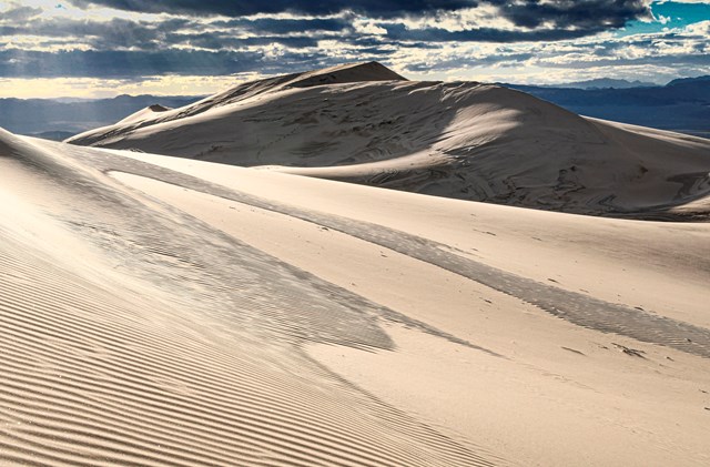
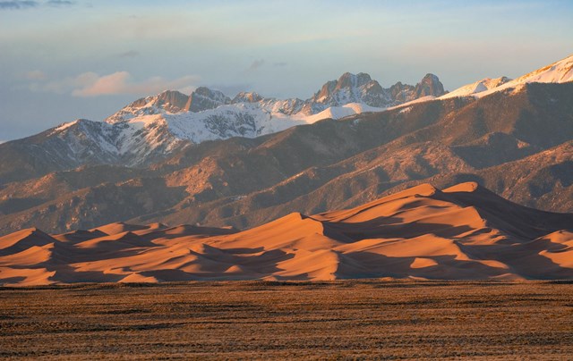
Great Sand Dunes fees, hours and alertsThe park says it plainly: there are no trails in the 30-square-mile dunefield at Great Sand Dunes. High Dune on the First Ridge is a common objective, but getting there still means crossing the Medano Creek bed and choosing a line among shifting ridges. Look behind you as often as you look toward the summit. The view back to the parking area can disappear when the next crest interrupts it.
A short map distance can take hours in soft sand, especially at elevation. Start early when heat or afternoon storms are possible, carry water and protect your feet. The park publishes coordinates for dune destinations, but a GPS point does not tell you which slope is sensible to climb. If you plan to sleep among the dunes, stop and read the separate backcountry permit rules; a permitted day walk does not authorize a tent wherever the sand looks flat.
03Capitol Reef
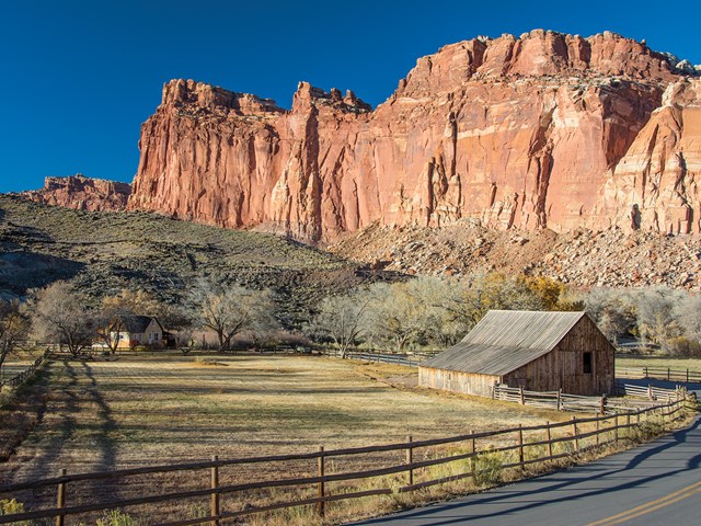
Capitol Reef fees, hours and alertsThe Waterpocket District of Capitol Reef gives you routes rather than a single idea of "off trail." One begins on a recognizable track and follows a wash; another uses cairns before entering a narrow drainage. Farther south, Halls Creek Narrows can be a multi-day undertaking with water obstacles. The park's route descriptions matter because they explain which parts are visible on the ground and where you must navigate for yourself.
Pick a named route matched to your experience and read its full park description. A dry wash is not a safe place during a flash-flood threat, including storms you cannot see overhead. Bring enough water and know the remote road that leads to your start. Overnight camping has its own permit requirement. This is the park for learning to read sandstone and drainage, provided you leave enough time to retreat when either disagrees with your plan.
04Badlands
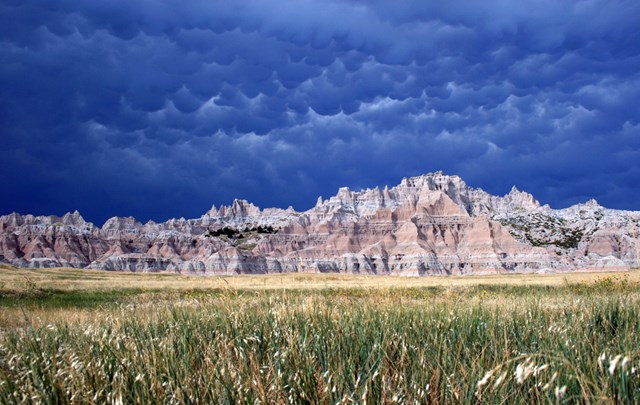
Badlands fees, hours and alertsBadlands has an Open Hike Policy: visitors can leave established trails and explore places such as Deer Haven or Sage Creek where conditions allow. The striped formations make an enticing maze. They can also look very different on the way back, and the park warns that climbing up may be easier than descending. Mark a return bearing before choosing a spur between walls.
The park notes that backcountry cell service is limited. Talk with a ranger about conditions, keep distance from wildlife and leave fossils, stones and artifacts in place. An open-hike policy is not a license to damage fragile formations or ignore a specific closure. Start with a short exploratory walk rather than a long cross-country promise. You can learn plenty from the first ridge if you still have the time and certainty to return.
05Lake Clark
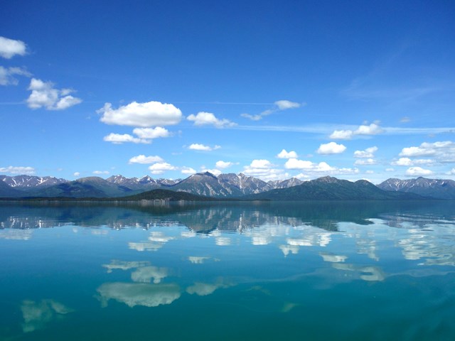
Lake Clark fees, hours and alertsLake Clark calls itself trail-less wilderness outside the maintained Tanalian routes near Port Alsworth. The absence of trail signs is only the beginning: river fords, bogs, brush and changing weather determine what a line on the map becomes underfoot. The park advises a slow pace and suggests a local guide if your own route-finding skills are not enough. This is not an introductory off-trail afternoon disguised as a grand landscape.
Plan a route from terrain and water crossings, then name a fallback if a river rises. A GPS fix can tell you where you are on the wrong bank, but cannot make the crossing safe. Access to the start and a pickup plan also need more thought than at a roadside park. Choose Lake Clark for a self-supported wilderness journey only when the group can navigate, manage weather and change the itinerary without improvising its safety.
06Dinosaur
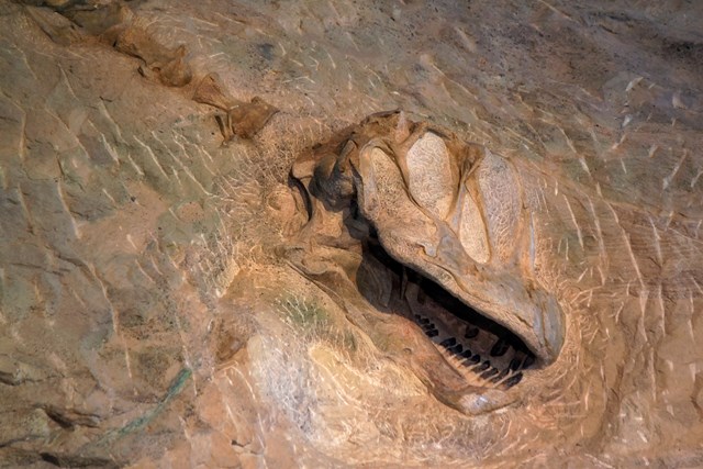
Dinosaur fees, hours and alertsMost of Dinosaur National Monument is open to cross-country travel beyond its established trails. The park's off-trail guide warns that well-known routes may still be unmaintained and remote, while less-visited ones require stronger technical skills. The river canyons and exposed rock invite ambitious plans. Look at a route description as a starting brief, not as a built path you can expect to follow.
Carry the equipment and judgment to spend longer out than intended, even on a day trip. The park explicitly advises being ready for an unexpected night. Overnight backcountry travel requires a permit, and some specific camps require reservations. Distinguish a day hike from a camping plan before the drive to a remote start. Dinosaur gives capable hikers room to choose, which means a large share of the decision-making stays with you.
07Petrified Forest
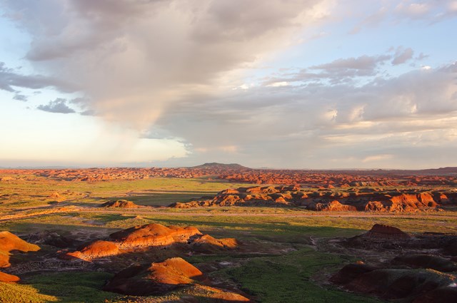
Petrified Forest fees, hours and alertsPetrified Forest welcomes off-trail exploration outside developed hiking areas, while directing walkers to stay on designated trails where required and avoid closed, fragile ground. Its "Off the Beaten Path" routes offer visitor-center guidance without pretending every line is a maintained trail. Painted Desert wilderness and eroded badlands can make a short wandering route absorbing enough for a full afternoon.
Get the current route information at the visitor center and park legally. Day hikes usually need no permit, but Devils Playground is an important exception with limited permits. Check the specific area's rules before choosing it. Do not collect petrified wood or dig for a better find, and avoid damaging formations for a shortcut. The best off-trail day here is a close look at geology that leaves no trace of your curiosity.
08Isle Royale
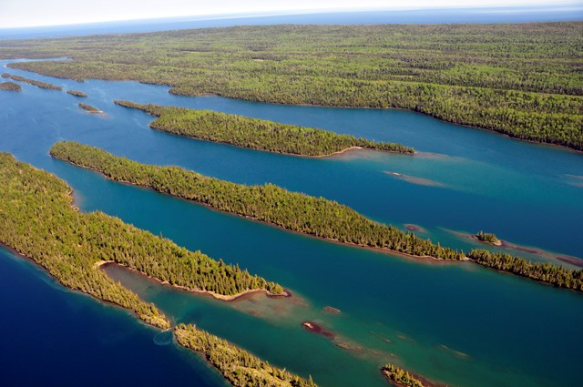
Isle Royale fees, hours and alertsIsle Royale permits a more demanding kind of wandering in designated off-trail camping zones. The park describes thick vegetation, swamps and rough terrain, and advises people new to the experience to try a day hike before attempting an off-trail camp. A map and compass are essential, as is the ability to select a low-impact site before the light fades. Solitude here costs effort; it is not an overflow option when ordinary campgrounds are busy.
Overnight travel needs an additional off-trail permit specifying the zones where you may camp, with rules on site placement and fires. Do not infer an overnight right from a day-hiking opportunity. Island access, changing weather and the return connection all make preparation consequential. Go if you want the careful craft of traveling lightly through difficult country, not if you want a shortcut between signed trails.
09Assateague Island
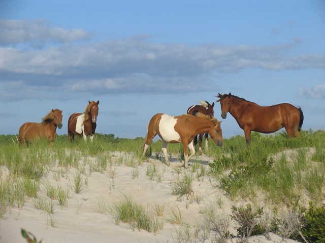
Assateague Island fees, hours and alertsAssateague Island offers miles of beach where there is no constructed path to follow. The park warns that soft sand, few landmarks and deceptive distances can make a flat-looking walk unexpectedly hard. A low tide may offer firmer footing, but the ocean side is still exposed to wind and changing conditions. The simple route follows the shore; the hard part is judging how far you can comfortably return.
This is not a license to cut through dunes, wildlife closures or private access. Check the district's current map, beach conditions and any protected areas. Sturdy shoes, water and a firm turnaround matter more than a heroic mileage goal. If you plan an overnight outing, use the park's separate campsite rules. An open beach gives room to walk; it does not make every patch of island ground available for a tent or shortcut.
10Channel Islands
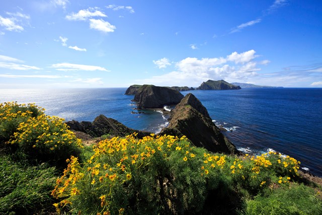
Channel Islands fees, hours and alertsAt the Channel Islands, the idea of going beyond a built route comes with unusually sharp boundaries. Some shore travel begins by kayak and has specific landing rules. The park warns novice paddlers away from independent sea-kayaking trips and describes fog, currents and changing sea conditions that demand serious skill. Once ashore, an island can still restrict off-trail travel or require an escorted visit. "Remote" never means "unregulated."
Plan from the particular island's current rules, not a general promise of freedom. A guided sea-kayak outing may be the right way to experience a stretch of wild coast without taking on its navigation alone. If you intend to hike beyond a route, confirm that exact area is open before launch. The reward is solitude and a rare view of the islands. The price is knowing where you can land, walk and safely return.

When to go: the season decides the route
Spring is about water and ground. Streams can make a Lake Clark route impassable, and snow can linger at a high-country start. Badlands clay or a desert wash changes after rain. Look for current conditions rather than an appealing date on last year's trip report; choose a route with a sensible retreat.
Summer rewards early starts. Sand at Great Sand Dunes can become punishing in sun, and Capitol Reef slots can be dangerous when storms build upstream. Denali's buses and long daylight make route choices possible, but brush and river crossings still slow travel. Decide your turnaround before you begin, not once the weather gives you one.
Fall can bring better walking temperatures and less daylight. Petrified Forest and Badlands may be comfortable for a short exploratory day, while remote parks begin to lose seasonal access. A route that took all day in midsummer may need to be shortened. Give yourself daylight for the uncertainty that makes an off-trail hike an off-trail hike.
Winter belongs to a different skill set. Snow can erase landmarks and make a slope hazardous; a park road may be closed well before the scenic landscape is. If you lack winter navigation and hazard training, choose a maintained, open trail instead. The ability to travel off trail is not an obligation to do it in every season.
How to build a route that comes home
- 1
Find the exact legal ground. Read the park's current closure map and area-specific rule. Badlands' open-hike policy, Petrified Forest's developed-area exceptions and Channel Islands landing rules are not versions of one national permission.
- 2
Make a return plan first. Mark the start, landmarks, turnaround and exit on a map that works offline. Know how to use a compass before the trip. Sand and washes can look different in reverse; a phone battery cannot substitute for a bearing and a sensible landmark.
- 3
Budget for the slowest obstacle. Soft sand, brush, a river ford or a ferry-like access connection can dominate the day. Lake Clark's wilderness pace is not a paved-trail pace. Give someone outside the group your intended route and return time.
- 4
Separate walking from sleeping. A park may allow day hiking widely while requiring a backcountry permit or designated zone for overnight use. Denali, Dinosaur, Isle Royale and Great Sand Dunes each have distinct camping rules. Get the right permission before the outing, not at dusk when the hike has run long.
- 5
Turn back before a forced decision. A swollen river, storm above a canyon, closed landing or exhausted companion is enough. Leave wildlife space, stay out of restoration areas and avoid carving a new route through fragile ground. The trip is successful when the group and landscape both come through intact.
A short history of paths that were never built
People crossed these landscapes before trail blazes, road maps or park boundaries. River corridors, dry washes, passes and shorelines gave direction, but they never removed the need to read weather and ground. A route could be known without being a constructed path. That distinction remains useful in a park where a wash is easy to follow until a storm changes it.
As parks built visitor trails and roads, they made some journeys easier to repeat. They also left vast areas without constructed paths. Denali's tundra and Lake Clark's wilderness ask for decisions that a sign cannot make. At Great Sand Dunes, a footprint may vanish overnight. Freedom from a marked route is an experience, but it comes with responsibility for wildlife, fragile terrain and the people who may have to search if someone fails to return.
Modern GPS makes it easier to know a position and sometimes too easy to confuse that with knowing a safe way forward. Park route sheets, maps and permit systems now help define where an independent traveler can go with care. The old skill still matters: look at the country, choose a line you can defend and keep enough time to reverse it.
All 22 parks with off-trail permitted hiking
Below are Park Service units that list off-trail hiking opportunities. Check the specific area's access, closures and camping rules before leaving a marked path; a place in the directory does not open every slope or overnight site.
Free to enter Charges an entrance feePoints are the Park Service reference point for each unit, not a boundary.