A blue dot is persuasive until a battery dies, a canyon blocks the signal or the line on a phone is not a trail. A map lets you see the country around your route; a compass tells you which way that country lies. GPS can help fix your position, but it does not decide whether a river can be crossed or whether the beach ahead is legal to enter. The best park trips use all three tools without asking any one of them to do the whole job.
The Park Service lists 34 units with compass and GPS activities. They range from Great Sand Dunes' trackless sand to the marked orienteering course at Catoctin. Some places permit off-trail travel; others require a precise chart to stay within the right waterway or a map to stay on the legal route. These ten give navigation a real purpose. Pick an experience that matches your skill, carry a way back that does not depend on cellular service, and treat the park's current map as more important than a line copied from an old trip report.
The ten best national parks for compass and GPS skills
01Great Sand Dunes
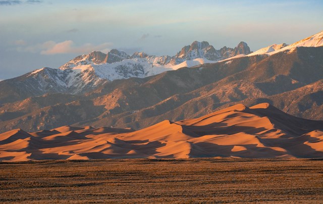
Great Sand Dunes fees, hours and alertsThirty square miles of dunefield and no trails in the sand: Great Sand Dunes makes navigation visible at every step. The park publishes coordinates for destinations such as High Dune on the First Ridge and Star Dune, but a waypoint does not flatten the intervening ridges. Pick a line across the Medano Creek bed, climb on firm ridgelines where you can and look back often. The most important landmark may be the one that helps you find the parking area again.
A device can confirm your position, while a paper map and compass help you understand why the route you planned does not match the folds of the sand. Heat, elevation and thunderstorms can turn a modest-looking distance into a much longer day. The park warns that popular third-party hike tracks can be inaccurate. Download its own route information, start early in warm weather and choose a turnaround time before the dunes erase your sense of progress.
02Badlands
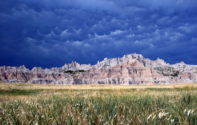
Badlands fees, hours and alertsBadlands has an Open Hike Policy: visitors may explore off-trail where they can do so safely. Deer Haven and Sage Creek offer very different ways into that freedom. The eroded formations can hide the return line, and a slope that seems easy going up may be difficult to descend. Before leaving a known route, mark the trailhead, note the shapes you are passing and check how they look from the other side. A compass bearing toward home is more dependable than a memory of a beautiful wall.
The park warns that backcountry cell service is scarce. Talk to a ranger about conditions and keep a generous margin for the return. Do not damage formations or collect fossils, rocks or artifacts; the ability to leave the path does not make the landscape a free-for-all. This is a strong place to practice decisions on a short outing before trying a longer cross-country route. The best navigation lesson may be knowing when to turn around.
03Lake Clark
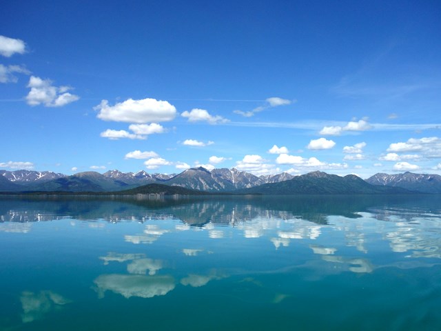
Lake Clark fees, hours and alertsLake Clark calls itself trail-less wilderness, apart from the maintained Tanalian routes near Port Alsworth. Away from them, a map is not simply a record of where you have walked; it is your argument for where you can walk next. Rivers need fording, bogs can force detours and the route that looks short on a screen may be impassable after rain. The park suggests a slow pace in country where finding a way is part of the travel itself.
This is not a place to learn your compass on arrival. Study terrain, crossings, access and a safe turnaround before committing to a drop-off or camp, or hire a guide with local route knowledge. Carry the map at a scale that shows the landforms you will actually use. A GPS fix can tell you exactly which side of a swollen river you are on. It cannot get you to the other side.
04Everglades
Everglades fees, hours and alertsEverglades poses the water version of the same problem. Mangrove shorelines repeat, channels bend and more than 800 square miles of marine water stretch between the Ten Thousand Islands and Florida Bay. The park publishes map and navigation materials, including boating zones, campsite locations and channel information that can be loaded into GPS tools. Some waters require particular operating methods; a direct line to a destination may cut across a restriction or shallow ground.
Download the park's current navigation materials and carry appropriate charts before launching. Look at the management zones as carefully as the route itself. Markers can change or be difficult to see, and the park has noted replacement work after Hurricane Irma. A GPS point helps you know where you are; the chart helps you decide which channel you should be in. In a mangrove maze, both questions matter.
05Channel Islands
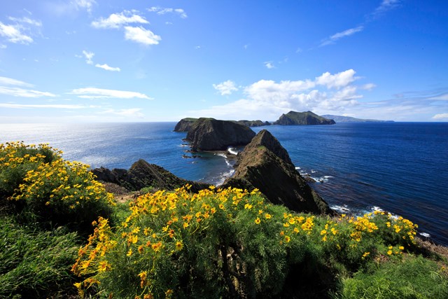
Channel Islands fees, hours and alertsThe Channel Islands demand a mariner's sense of direction, not just a hiker's. The park's kayaking guidance calls for nautical charts and notes that fog can arrive even when a departure looked clear. Currents and sea conditions can change quickly; caves and cliffs raise risks that no GPS can cancel. Scorpion Beach may be easier to access than other island shorelines, but there is no protected cove for kayaking here. Treat it as open-water travel.
The park advises against independent kayaking here for novices. Go with a qualified operator if you do not already have sea-kayak navigation and rescue skills. Experienced paddlers should study the Coast Guard's local notice, NOAA charts, landing rules and weather, and carry a compass and VHF radio as part of a full safety kit. A breadcrumb trail on a screen is useful. In fog, it is not a substitute for knowing the chart or having a safe plan to get home.
06Crater Lake
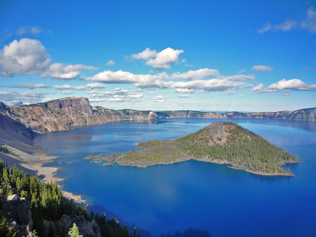
Crater Lake fees, hours and alertsThe lake is an unmistakable landmark until winter weather removes visibility. Crater Lake warns snowshoers and skiers that a clear day can turn to whiteout quickly; its winter backcountry guidance says to carry a map and compass because batteries and GPS devices can fail. Winter travel also crosses avalanche terrain and passes near cornices on the caldera rim. Finding a line on the map is only one part of choosing a safe route.
This is for people with winter travel skills, not a first compass lesson in deep snow. Check permit rules, road access, forecasts and current hazard advice. Plan a shorter out-and-back with a firm turnaround, and know the alternate route before weather closes the view. The park's winter guidance suggests bypasses around avalanche areas. The map needs to show those choices, not just the most scenic line around the lake.
07Petrified Forest
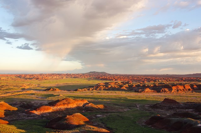
Petrified Forest fees, hours and alertsPetrified Forest invites hikers off the pavement on its "Off the Beaten Path" routes, with instructions to ask at visitor centers for route information. The park says route-finding skills are needed and distances are approximate. That makes it a useful step between an ordinary marked trail and a fully self-designed cross-country day: you have a destination and park guidance, but you still need to read the terrain between them.
Park safely and legally, then take the current route sheet or map with you. Fragile badlands and exposed petrified wood call for restraint: do not collect or dig, and avoid damaging formations for a shortcut or a better photo. Mark your return point before starting. A route that bends through colorful hills can be harder to reverse than it looks from the road. The park's geology rewards the slow walk; it does not reward a rushed line home.
08Catoctin Mountain
Catoctin Mountain fees, hours and alertsIf you need to learn what a map and compass can do before entering trackless country, Catoctin Mountain has described a visitor-center orienteering course with beginner control points. The park has loaned maps and compasses for the activity. Finding a series of points is a way to practice bearings and map reading with a clear goal rather than trying those skills for the first time when you are already lost.
There is a catch worth putting before the trip: the park says the course is being evaluated and may be inaccessible. Confirm its current status with the visitor center before traveling for it. If it is open, follow the course and group-reservation guidance rather than making your own shortcuts through sensitive ground. The site's orienteering guide covers the sport more fully; this stop is here because an introductory course can make your later backcountry navigation safer.
09Shenandoah
Shenandoah fees, hours and alertsShenandoah has a dense network of trails, so the navigation challenge is less about a blank map than about choosing the correct junction, campsite and return. The park provides an interactive backcountry map to show where camping is allowed and where it is not. A line drawn to an attractive valley is not necessarily a legal overnight plan. Build the route from the park's current rules, then carry a map that will work without signal.
The park's hiking advice asks visitors to know where they are and where they are going at all times. That is especially useful when a trail intersects a road, a side trail or another ridgeline. Note junctions and water before the day begins; make the compass a check on your sense of direction rather than a last resort. For a newcomer, a short loop with several junctions is a better practice session than a long overnight itinerary arranged around a phone battery.
10Assateague Island
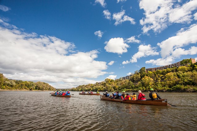
Assateague Island fees, hours and alertsAt Assateague Island, bayside and oceanside backcountry camps invite a different kind of map reading. The park publishes a camping map showing sites accessible to backpackers, canoers and kayakers. Water access, landing places, wind and the division between beach and bay matter more than a straight-line distance. Choose the legal destination first, then see how the approach works in the conditions you are likely to meet.
A paper map can orient you to the island and campsite, while a suitable marine chart and current park information are needed for a paddling trip. Check campsite permits, access and weather before launching. Do not confuse a public beach with permission to land or camp anywhere along it. The island is narrow on a map and far less simple on the water when wind or light changes.



When to go: conditions change the map
Spring is when a drawn crossing can fail. At Lake Clark, high water can stop a ford; at Badlands, rain can make clay and formations dangerous. Ask about current conditions before relying on a route through a drainage. A GPS track made in a dry year is not a bridge over this year's stream.
Summer brings heat, storms and fog. Start early on the sand at Great Sand Dunes, carry enough water and watch the sky. Channel Islands fog can remove the coastline from view, while the Everglades adds heat and complicated water routes. Decide whether you have the skills for the place, not just whether a tour or boat is available.
Fall can be a fine practice season. Cooler days may make a short Badlands or Petrified Forest route more comfortable, but daylight shrinks and a late start eats into your return margin. Choose a simple route, set a turnaround time and use the map as you go. Waiting until you feel lost to unfold it defeats the point.
Winter raises the stakes. At Crater Lake, snow can cover signs and a whiteout can hide the caldera; avalanche and cornice hazards require more than navigation skill. In Shenandoah, winter conditions can also change a routine trail day. Carry the right equipment and know when the prudent route is back to the vehicle.
A short history of finding a way through the parks
Maps and compass bearings long preceded the small glowing position marker. Travelers crossed deserts, waterways and mountains by reading landforms, estimating distance and keeping a direction. A chart made waterways legible, but a shoal or storm could still make the plotted course unusable. The distinction survives at Everglades and the Channel Islands: knowing your position and knowing your safe passage are separate tasks.
The arrival of portable GPS made a precise position available to many more visitors. Parks began publishing useful coordinates and digital map files, as Great Sand Dunes and Everglades do. That is a genuine improvement. It can also create false confidence when a point on the screen looks like a promised route. The landscape has not signed the same agreement as the software.
Today a beginner can practice bearings on a marked course, while an experienced traveler can combine satellite position with a topographic map, chart and local conditions. The tools changed. The central question did not: what lies between here and where you want to go, and can you return by a safe way? The better navigator answers both before leaving.
All 34 parks with compass and GPS
Below are Park Service units that list compass and GPS activities. Open the park's current map, route guidance and access rules to see whether your plan belongs on a trail, across open country, on snow or on water.
Free to enter Charges an entrance feePoints are the Park Service reference point for each unit, not a boundary.