A geocache gives a hike a second destination: an object, a question or a place you would have walked past. In a national park, the search comes with a condition. You cannot simply hide a container where you please. Parks generally prohibit unauthorized cache placement, and the best park hunts are the ones the park has planned or allowed. A box beside a fragile site is not a gift to the next visitor, however clever the clue.
The Park Service lists 26 units with geocaching. Some offer whole GeoTours across a region; others have EarthCaches with no container at all. That variety is the fun. A Chesapeake trail can make several days of history out of a GPS route, while a geological question at Shenandoah can change how you see a single outcrop. Start with the official park page, then check the live cache listing for current status and access rules. These ten earn a look for the place the hunt leads you, not for the trinket at the end.
The ten best geocaching trips in the national parks
01Captain John Smith Chesapeake
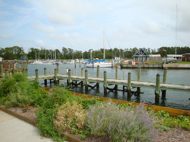
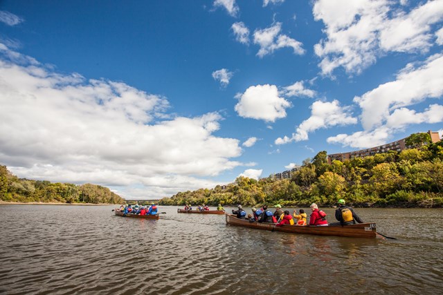
Captain John Smith Chesapeake fees, hours and alertsA national historic trail spread across water needs a different way of drawing people to its stories. The Captain John Smith Chesapeake GeoTour answers with more than thirty sites on six rivers, each tied to a place or scene from Smith's Chesapeake voyages. Volunteer geocachers helped create the route. Some stops invite a paddle; others fit a drive and a walk. Together they make the trail less abstract than a long blue line on a regional map.
The park provides a map and a route to the coordinates from its geocaching page. Choose one river for a first outing rather than treating all thirty-plus stops as a single day's checklist. Check access and current cache status before traveling to a shoreline; a water trail does not promise that every landing is open to every visitor. The reward is noticing how the history lies along the river, not finishing the app's counter.
02Star-Spangled Banner Trail
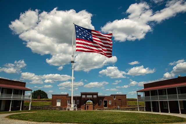
Star-Spangled Banner Trail fees, hours and alertsThe Star-Spangled Banner GeoTrail connects more than thirty sites around the Chesapeake to the War of 1812. Museums, battlefields, waterfronts and communities make the story larger than the bombardment of Fort McHenry alone. The park's trail page points to Geocaching.com for the route and clues. It is a strong weekend project for a family that likes solving something together between museum stops.
A series across many institutions needs more planning than a container in the woods. Check each stop's access, parking and opening hours separately; some locations are best experienced while the site itself is open. The Smith and Star-Spangled routes cross some of the same broad region, but they ask different historical questions. Do one route well, then try the other. Completing a sequence means little if you never go inside the place it brought you to.
03Petrified Forest
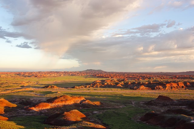
Petrified Forest fees, hours and alertsPetrified Forest gives geocachers a proper menu: traditional and virtual caches, EarthCaches about geology and stops tied to the Historic Route 66 Geocaching Project. The park points visitors to its two visitor centers for nearby starting opportunities. That range suits a first-timer who wants a simple find and a more experienced player who would rather answer a question about a landscape than trade plastic objects.
Plan for the park road between finds. Distances that look small in a cache app can become a slow drive with stops worth making in their own right. Follow the park's current rules for where to walk, and leave petrified wood and fragile soil untouched. A container is never a reason to dig or scramble across a protected feature. The most memorable finds here are likely to be the ones that explain the ground beneath you.
04Everglades
Everglades fees, hours and alertsThe "Park Employee for a Day" trail at Everglades asks visitors to consider management decisions about a complicated landscape as they find caches. The park also describes a series about restoration. These are park-developed hunts, and the park says the information needed to find its restoration caches can be used without a Geocaching.com account. It is a more thoughtful premise than collecting coordinates: each stop asks what it takes to care for a place where water, wildlife and people keep meeting.
The park's geocaching page also states the rule directly: unauthorized cache placement on Park Service land is generally prohibited. Hunt the approved series, leave each container as directed and report a damaged one to the park rather than replacing it yourself. Check for current locations and access before going. An Everglades route can change with water or closures, and the park page is a better guide than an old log from a previous season.
05Shenandoah
Shenandoah fees, hours and alertsShenandoah favors the container-free version. Its EarthCache program leads visitors along selected trails to geological and natural features, then asks questions answered by observation rather than a logbook in a box. The park calls it a family-friendly, self-guided activity. A child who can see a rock face and ask why it looks that way is doing more of the work than someone who only punches in a coordinate.
The park expressly says traditional physical cache placement is not permitted. Follow the listed EarthCache route, stay on the designated trail and read the educational prompt before you arrive at the point. An EarthCache can be an excellent reason to take a second look at a familiar overlook. There is no container to unearth and no prize to carry away. The place itself is the find.
06Santa Monica Mountains
Santa Monica Mountains fees, hours and alertsA GPS activity at Sandstone Peak gives Santa Monica Mountains a specific EarthCache-style outing. The park directs visitors to the Geocaching.com coordinates, then back to a quiz that tests what they learned at the site. The question matters: it makes you use the location rather than merely prove your device reached it. On a clear day, the walk has its own reason to happen, with the peaks and coast visible from the route.
Check the park's current trail conditions, the cache listing and the quiz link before driving to a single stop. Keep to the permitted path and do not mistake coordinates for permission to cut across vegetation. This is an accessible way to try a container-free hunt if you already know how to prepare for a hike. Bring water and a route home; the app is not a substitute for the park map.
07Mississippi National River
Mississippi National River fees, hours and alertsThe Mississippi National River and Recreation Area runs through a working urban landscape rather than a single fenced entrance. The park explains what geocaching is, but its page does not name a specific park-approved cache or route. Check the current listing and park access rules before building an afternoon around a find.
The breadth of the corridor makes current access important. Check each cache's live listing, the land manager and the park's directions rather than assuming every pin is on National Park Service ground or open at all hours. A city river can surprise you with a quiet reach around the next bend; it can also put a cache across a road, rail line or closed gate. Follow the lawful route, not the shortest line your phone draws.
08Acadia
Acadia fees, hours and alertsAcadia has a five-stop EarthCache course on its Park Service tour pages. Its glacial valleys, striations and erratics reward close attention, and a container-free search asks you to observe and answer rather than dig near a feature. It can slow down a familiar scenic drive enough that the rock itself becomes interesting.
Find the current EarthCache listing, read its questions and check the park's trail and road conditions first. Do not leave a container, move a stone or step into closed ground for a better answer. An EarthCache should help you see a protected feature, not consume it. Acadia also has crowded routes in peak season; a short walk to a designated viewpoint can be a better plan than a hurried series of far-flung coordinates.
09Keweenaw
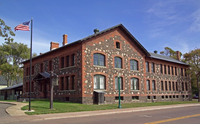
Keweenaw fees, hours and alertsKeweenaw has hosted a geocaching adventure connected to its copper-country history. The park's archived announcement shows how a cache hunt can bring visitors to the places behind an industrial story. It does not establish an active route today. This is a lead to investigate, not a reason to book travel around a cache that may no longer exist.
Look for a current park or partner route, and check the live listings before attempting any stop. Keweenaw's sites are spread through communities and former mining landscapes; opening hours and land ownership vary. If there is no current sanctioned hunt, explore the park's museums and historic places for their own sake. A past geocaching project is history too, but it is not a live appointment with a hidden box.
10Indiana Dunes
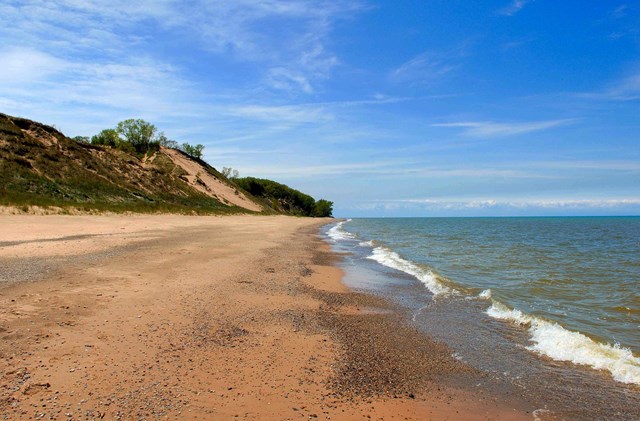
Indiana Dunes fees, hours and alertsIndiana Dunes has one of the clearest official geocaching menus: park-owned traditional finds at Chellberg Farm, EarthCaches about dunes and other landforms, Adventure Lab experiences and virtual stops at historic sites. It is a good place to choose the kind of hunt you want before opening an app. At an EarthCache, questions about a bog or beach process make the landscape do the teaching. At a traditional cache, the familiar logbook remains part of the fun.
Use the park's geocaching page as the starting list and check each active listing before traveling. Be careful near dunes and sensitive plants; a GPS point is not a license to trample a shortcut. The park documents the activity in detail, making it a strong choice for a first trip with several kinds of find. Start with its park page to plan your visit.


When to go: the cache is not the whole trip
Spring can make a route easier to read. Before leaf cover and summer heat, an EarthCache on a marked trail can be a comfortable first outing. Rain and muddy ground may close or damage access. Check the park's current conditions and do not let a live cache listing overrule a trail closure.
Summer suits long regional routes. The Chesapeake GeoTours can become several days of history, but museums and waterfront stops each keep their own schedules. In Everglades, heat, insects and water conditions affect the day. Plan one manageable cluster of finds and leave room for the sites themselves.
Fall rewards a slower geology walk. Shenandoah or Acadia can turn a scenic stop into an observation-based hunt. Crowds and short daylight still matter. Download clues for offline use and set a turnaround time before beginning a trail with a child or a new player.
Winter makes current status essential. Some park roads or trails close, while urban river stops may remain possible. A cache log can be recent even when the legal route to it has changed. Check the park page, the live listing and the weather. If access is uncertain, save the hunt for a day when reaching the site does no harm.
How to hunt without harming the park
- 1
Start with park-approved opportunities. The Everglades says unauthorized cache placement is generally prohibited on Park Service land, and Shenandoah does not permit traditional physical cache placement. Do not place your own container because an app shows one nearby. Check the park-specific rule before you hunt or hide.
- 2
Read the live listing and the park page together. A GeoTour page explains the official route, while the app may show a cache as disabled or moved. The park's current closure and access rule wins if the two disagree. A coordinate is not permission to enter a closed area.
- 3
Choose the right format for your group. Traditional caches have containers and logbooks; EarthCaches ask you to observe and answer; virtual caches verify a visit without a box. A first hunt near a visitor center is better than a long, uncertain drive to a single difficult find.
- 4
Protect the ground and what is on it. Stay on trails and durable surfaces, do not dig or disturb artifacts, and leave a container exactly where the approved instructions specify. Report damage to the park or cache owner instead of inventing a repair.
- 5
Use the clue to learn the place. Captain John Smith's river stops and the Star-Spangled Banner route are historical itineraries, not simply pin collections. Go into an open museum, read the earth-science prompt and talk about what you found. The plastic object is rarely the best part.
A short history of the park treasure hunt
Geocaching grew with civilian access to accurate satellite positioning. A hidden container and published coordinates turned a technical capability into a worldwide game. National parks inherited the appeal and the problem at once: the search could draw visitors to overlooked stories, but unsanctioned containers or off-trail scrambles could damage protected places.
Park-developed routes answered with a more deliberate game. The Captain John Smith and Star-Spangled Banner trails use multiple stops to tell Chesapeake histories. Petrified Forest tied some finds to Route 66 and geology. The container-free EarthCache shifted the prize again: a visitor reaches a feature, studies it and answers a question, leaving nothing hidden behind.
The strongest modern programs are a bargain between curiosity and care. A park selects a durable place and a story; the visitor brings attention and a willingness to follow rules. No cache is worth a damaged artifact, dune or trail. The find should leave the park as it was and the person looking at it a little changed.
All 26 parks with geocaching
Below are Park Service units that list geocaching. Check the park's current page and the active cache listing for the kind of hunt, its location and whether it is still approved; a name in the directory is not a live cache.
Free to enter Charges an entrance feePoints are the Park Service reference point for each unit, not a boundary.